27 Oct Ward Boundary Review – Implications on River Ward
The City of Ottawa is reviewing its ward boundaries. The last major review was completed in 2005 and established the City’s 23 wards.
Ward boundaries must be reviewed periodically to balance population numbers and achieve other components of effective representation, as established by the Supreme Court of Canada and Ontario’s Local Planning Appeal Tribunal (formerly the Ontario Municipal Board).
Since the last major ward boundary review 15 years ago, Ottawa has seen considerable population growth, especially in suburban wards outside the Greenbelt. Some wards are growing twice as fast as others, creating population imbalances.
The Ottawa Ward Boundary Review 2020 is meant to establish boundaries that can be used in at least three municipal elections (2022, 2026 and 2030) and, perhaps, a fourth municipal election in 2034.
Based on direction from City Council, an independent, third-party consultant team is conducting the Ottawa Ward Boundary Review 2020 to ensure it is objective and impartial. The team is consulting the public, Members of Council and stakeholder groups, including school boards.
The project included two rounds of public consultation where residents and businesses were able to share their thoughts through surveys and discussions.
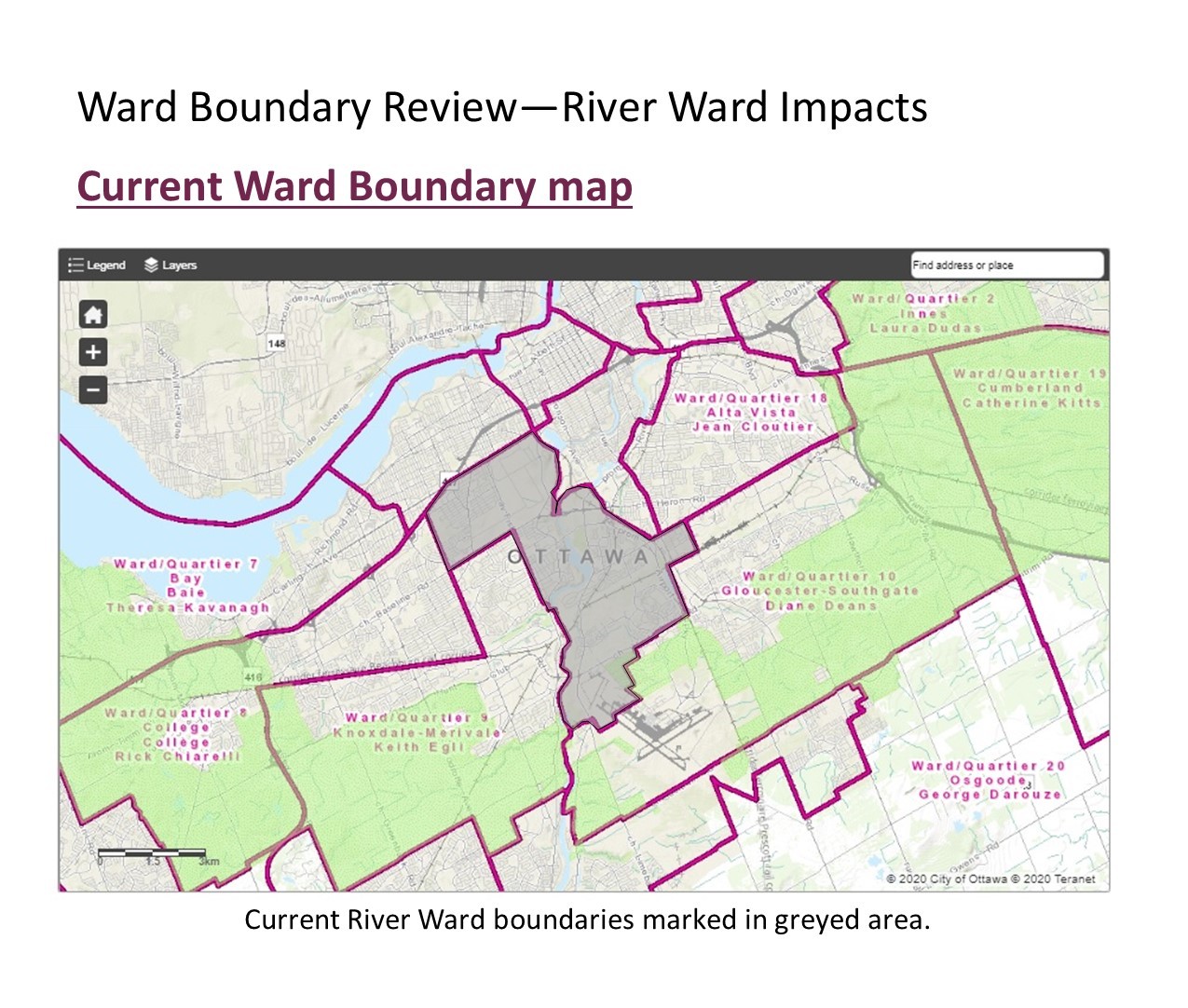
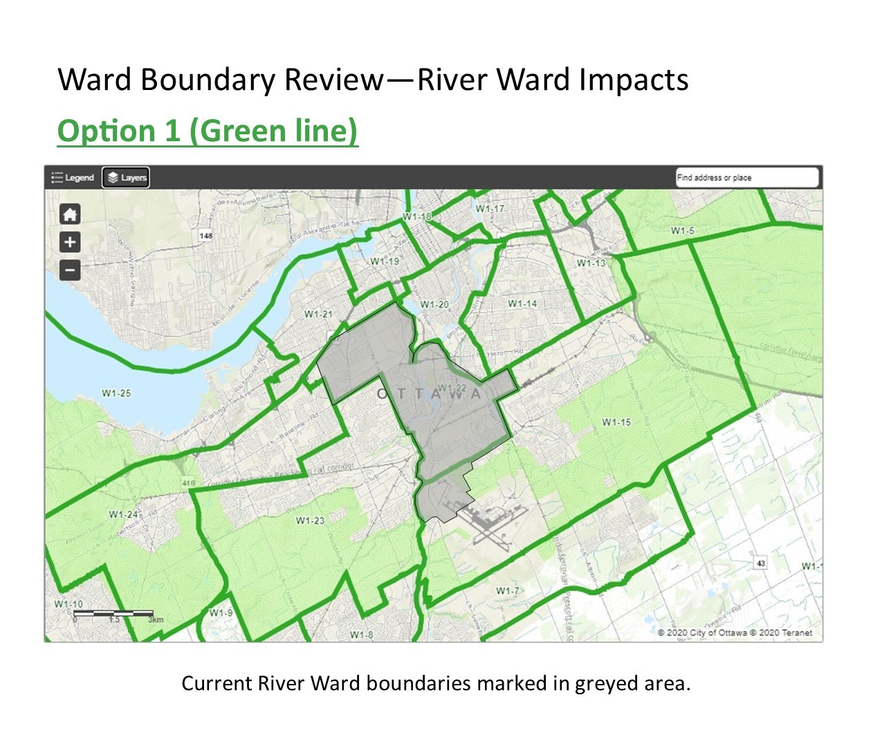
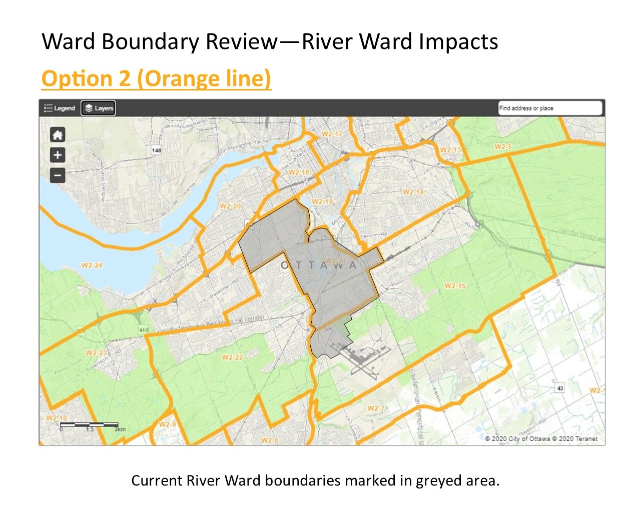
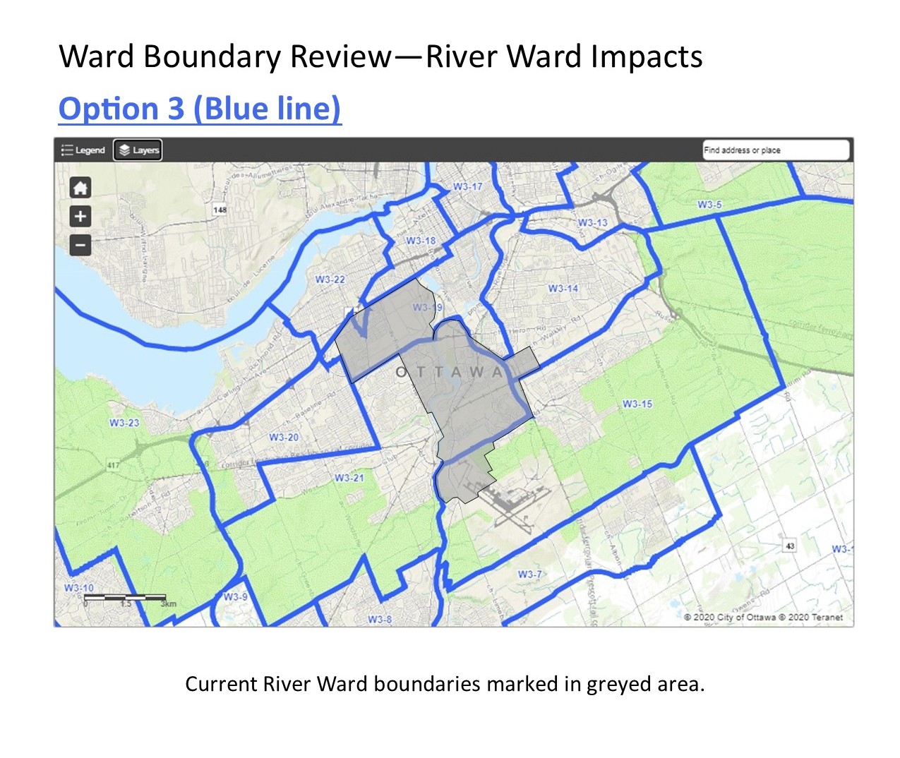
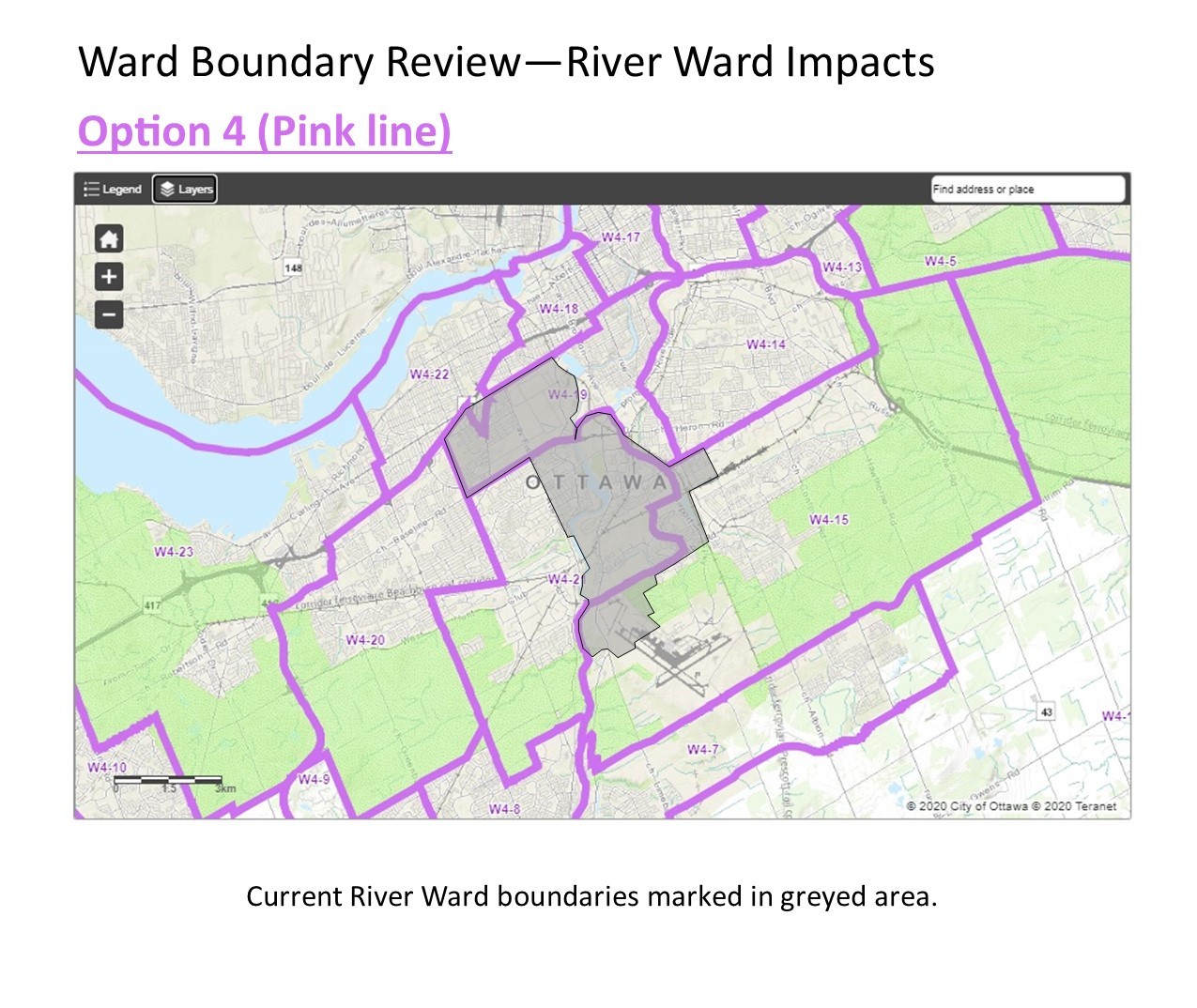
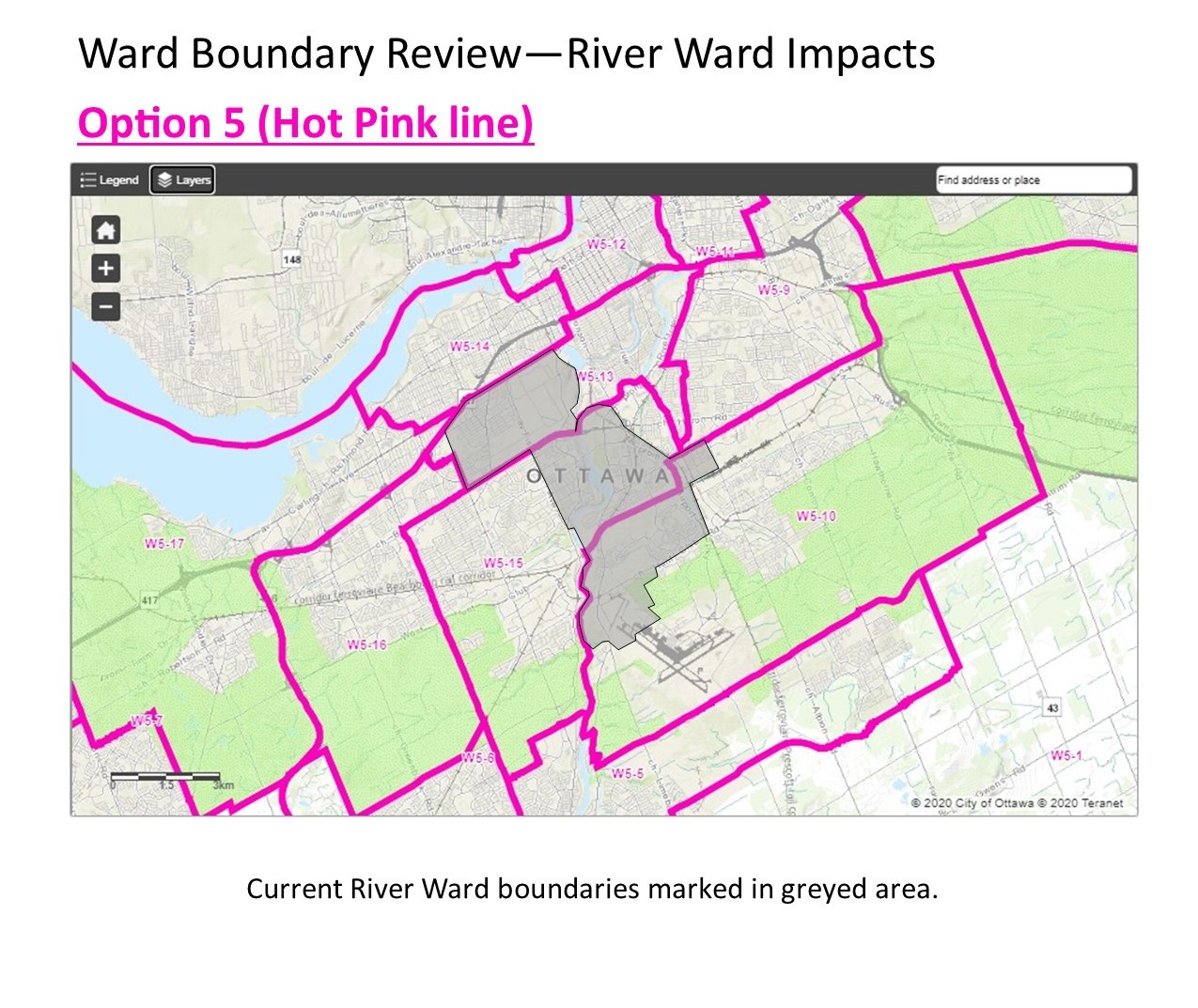
Initially, five options were proposed by the independent consultants with the following impacts on River Ward: (Click on the maps to enlarge them)
Option 1 increases the number of wards to 25, with 13 urban wards, 9 suburban wards and 3 rural wards. More or less keeps River Ward as is.
 Option 2 increases the number of wards to 24, with 12 urban wards, 9 suburban wards and 3 rural wards. More or less keeps River Ward as is.
 Option 3 maintains the current number of wards, 23, and includes 11 urban wards, 9 suburban wards and 3 rural wards. Splits River Ward at Heron Road. Merges northern half in to Capital Ward, merges southern half in to Knoxdale-Merivale Ward. Ridgemont goes to Gloucester-Southgate.
 Option 4 also maintains the number of wards at 23. It also includes 11 urban wards, 9 suburban wards and 3 rural wards. The boundaries for each ward are different than those in option 3. Splits River Ward at Heron Road. Merges northern half in to Capital Ward, merges southern half in to Knoxdale-Merivale Ward. Ridgemont goes to Gloucester-Southgate.
 Option 5 reduces the number of wards to 17, with 9 urban wards, 6 suburban wards and 2 rural wards. Splits River Ward into 4 different wards.
 On July 9, 2020, City Council directed the consultants to create a 6th option that would mitigate the impact on wards that don’t have a population imbalance.
Option 6 increases the number of wards to 24, with 12 urban wards, 9 suburban wards and 3 rural wards. It minimizes ward boundary changes. More or less keeps River Ward as is.
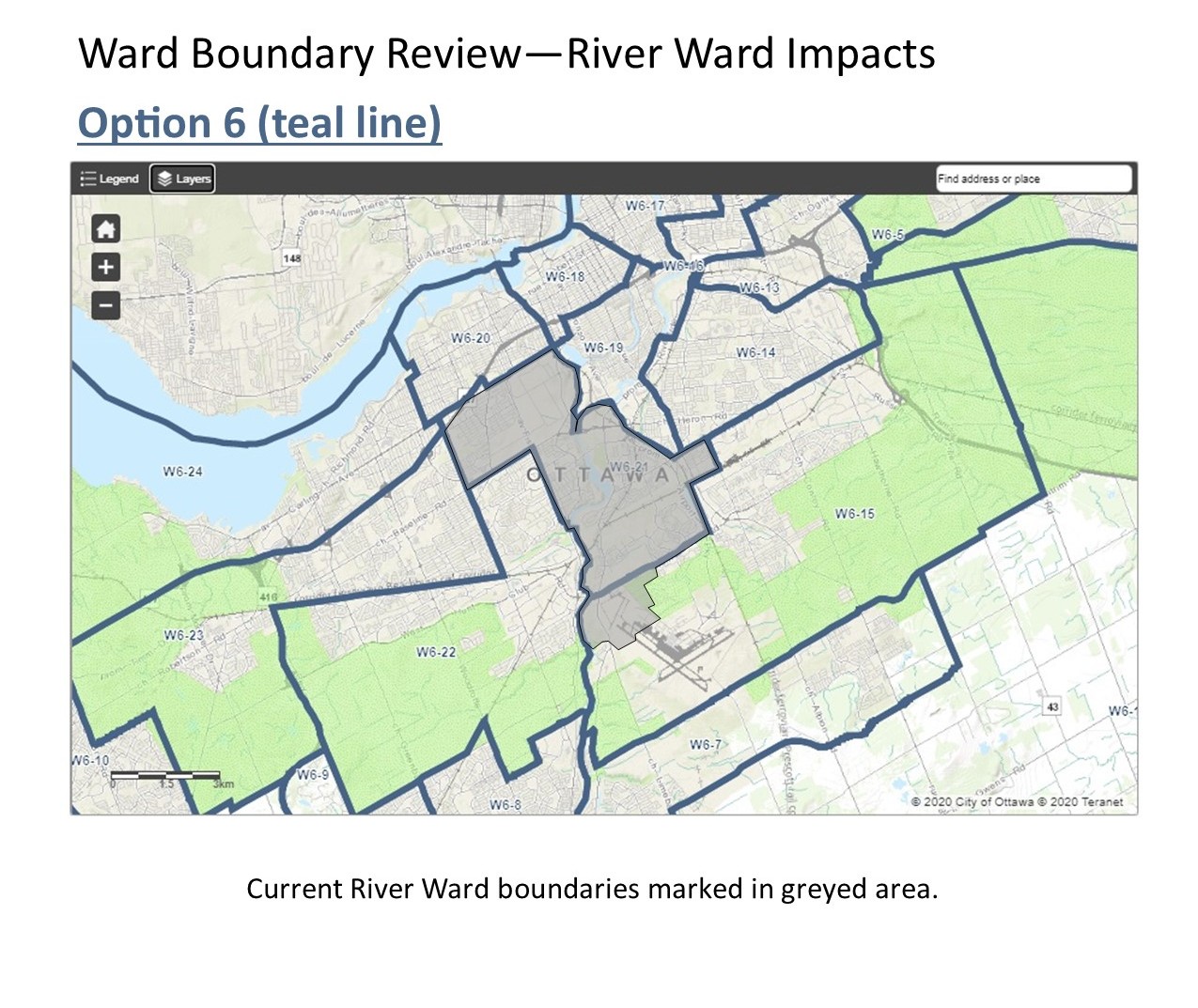 Following a on-line discussion with River Ward’s Community Association Presidents on July 22, whereby we discussed the ward boundary review and preliminary options, some of which are very intrusive on the geographic boundaries and communities of River Ward, I immediately picked up the phone and arranged a conference call with the consultants. In speaking with them, I underlined the need to keep Carlington and Hunt Club intact (there were proposals to also dissect these neighbourhoods) and the desire of Ridgemont to stay within River Ward. The consultants listened and when they developed Option 6, the ward is more or less as we know it today with the community’s requests honoured. The noted changes refine the southern boundary to Hunt Club Road, eliminating the residential, commercial and airport from the ward along the south side of Hunt Club and includes the addition of the Westgate Shopping Centre lands, currently in Kitchissippi Ward and Canadian Tire / Corel block of the south side of Carling Avenue between Clyde and the Queensway.
My preferred Option at this time is Option 6.
As always, please let me know if you have any questions, comments, or concerns.
You may find more information about this review here: ottawa.ca/wardboundary. On the city website, you can use the interactive map to zoom into your home address and apply the layers for the various options and see how it affects your home.
For a printable document of all the option maps above, click HERE.